PROFESSIONAL SERVICES
Services we provide
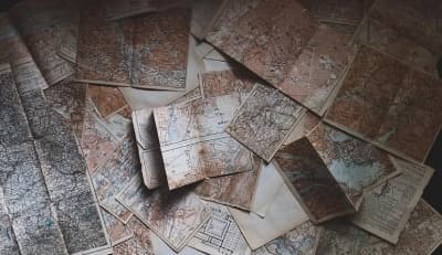
Every legal transaction involving Sale, Parental Grant, Donation, etc., must be accompanied by a topographic diagram (Law 651/77, Article 5). However, beyond legal requirements, an accurate topographic diagram ensures the precise positioning of your property boundaries indefinitely.

TOPOGRAPHIC STUDIES
We undertake the detailed and accurate mapping of your property according to the coordinate projection systems used in Greece, such as the Hellenic Geodetic Reference System 1987, always in compliance with the applicable specifications.
- Topographic Diagram for the National Cadastre
- Topographic Survey for the Forest Service Characterization Act
- Topographic Survey for Building Permit
- Topographic Survey for Property Sale
- Topographic Survey for Subdivision, etc.

TECHNICAL PHOTOINTERPRETATION REPORTS
Photointerpretation is the process by which, using aerial photographs and satellite images from public and private services, we can document the characterization of land in relation to applicable forest legislation (whether forested or not), the type of vegetation and crops within the examined property, determine the geomorphology of the terrain, prove the existence or absence of roads, old paths, streams, buildings, or other constructions (cultivated land, dry stone walls, etc.) at specific dates. The technical reports produced are submitted to court and various services for cases of property disputes, illegal constructions, encroachments, etc.

BUILDING PERMITS
We undertake all the necessary studies as well as the supervision of new building projects.
- Architectural Study, taking into account the architectural adaptation of the building to the surrounding environment and the clients requirements
- Photorealistic 3D visualization of the building under study for clients who want to see their planned building before construction begins
- Structural Studies
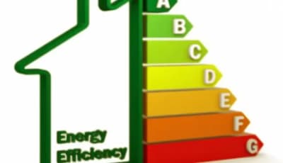
ENERGY INSPECTIONS
I undertake the energy inspection of your property and the issuance of the energy performance certificate in a short period of time, always in accordance with applicable specifications.
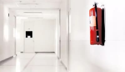
FIRE SAFETY STUDIES
The Technical Office undertakes the preparation of studies for fire protection and active fire safety systems.
TECHNICAL REPORTS
We undertake the preparation of well-documented technical reports to resolve property disputes, boundary disputes, as well as reports on the application of property titles that can be used in court.
SERVICES FOR PROFESSIONALS
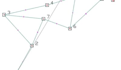
We provide support for professionals in the technical sector (architects, etc.) in the implementation of their projects, as well as for businesses (quarries, etc.) to ensure their smooth operation (volume calculations, etc.), and for larger projects to ensure the quality of the final deliverable (establishment and calculation of horizontal and vertical control networks for mapping, staking, and monitoring micro-movements).
- Establishment/Calculation of traverses
- Establishment/Calculation of Leveling Networks
- Establishment/Calculation of 2D/3D networks using the least squares method
- Detailed Technical Reports on Adjustments
- Mapping - Network Establishment - Staking
- Volume Calculations
- Topographic Studies
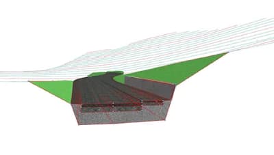
ROAD DESIGN STUDIES
Design of internal road networks for properties and land, traffic connection studies, road project studies.
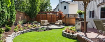
SPACE AND YARD DESIGN STUDIES
Our office designs and plans green spaces with an emphasis on aesthetically pleasing transformations, appropriate slopes for water drainage, and the creation of a microclimate using suitable shading systems in combination with ideal plants and trees, tailored to the clients needs.
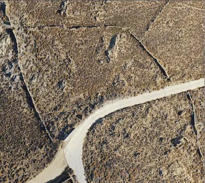
DRONE SERVICES
Our services include high-resolution aerial videography and photography at the appropriate altitude selected, using advanced technology and specialized equipment for each project. We also handle photo and video editing to ensure the appropriate quality for the final result, depending on the requirements of the task. Final deliverables include photos of plots, properties, buildings, fields, etc., as well as high-resolution orthophotos.
Highly Sophisticated Measurements
Measurements with a laser scanner lead to the production of a point cloud, and with appropriate processing we can create three-dimensional models of the object, industrial complex or monument, with the help of which we have the ability to subsequently produce elevations, floor plans or sections at any level.Terrestrial scanning uses a ground-based or tripod-mounted light radar (commonly referred to as LIDAR) to create high resolution 3D images of surfaces and objects. LiDAR measures a scanned object by emitting laser pulses and recording the subsequent intensity of their return when reflected off it. Scanning can be performed over kilometers with sub-centimeter precision. Terrestrial scanning is commonly used for heritage documentation, 3D topographical surveys, accident sites, confined spaces survey and Mechanical, Electrical and Plumbing (MEP) models.
Loading map...